September 06, 2009
Station Fire Moves Towards 2002 Curve Fire Burn
 Curve Fire can be seen in green in the image (click to enlarge)
I expect Dietrich has people on Highway 39 and has pulled up the old Curve Fire maps to look at old fire roads, breaks and reports. Recall Dietrich's tactics from the Zaca Fire when he drew the line in the sand on that fire's advancement at Highway 134 above Ojai. A fierce battle was waged by hundreds of firefighters and numerous aircraft on Highway 134 and the 240,000 acre monster fire died there.
The Fire has burned over 157,000 acres and is just over 50% contained. The latest InciWeb update has a detailed discussion of the fire's overnight activity and the Station Fire perimeter. That map is posted below.

Labels: 2009 Fire Season, Station Fire, Zaca Fire


August 14, 2009
La Brea Fire Estimated Over 100,000 Acres
Look at the image below. The Zaca burn is the purple outlined area south of the La Brea. You will note the La Brea has actually entered the two year old Zaca vegetation and appears to be established in the old burn.
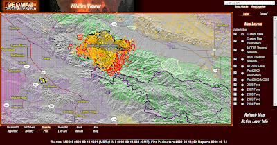 What can we expect from here. If the current weather pattern persists we could see the Le Brea continue its E/SE trajectory and burn all the way to Highway 33, just like the Zaca Fire. This outcome is weather dependent, little done by the fire command so far has managed to stem the rapid growth.
Please follow my Twitter updates here.
Labels: 2009 Fire Season, La Brea, La Brea Fire, Zaca Fire
August 12, 2009
La Brea Fire Meets Zaca Fire Perimeter

So what happens now? We know the Zaca Fire dozer lines are still in place so firefighters can anchor off those. Sisquoc Creek also offers a key potential fuel break for firefighters. If the La Brea blaze spots over and into the Zaca burn it will find two year old growth, a far cry from the 80 year growth it is feeding from currently.
I expect the fire to keep moving east as well as west. At this pace anything north of the Zaca perimeter that is green in the image above will burn. I would be surprised if this fire is held to under 100,000 acres.
Labels: 2009 Fire Season, La Brea, La Brea Fire, Zaca Fire, Zaca Fire Map
August 10, 2009
Zaca Fire Remembered
With the La Brea blaze about to touch the edge of the Zaca burn it is appropriate to reacquaint ourselves with the fire potential of this region.
Labels: Zaca Fire
August 09, 2009
La Brea Fire update
The La Brea Fire looks to have taken at least 15,000 acres in less than 24 hours. The area has not been visited by fire (to any extent) in decades. If the fire proceeds south it bumps against the 2007 Zaca burn. North or east and it can bump into the relatively flat Carrizo Plain.
As it moves northeast it will only impact more of the San Rafael Wilderness and the Los Padres National Forest. A run due west could impact the Santa Maria and Olivo (think Neverland) communities. There is no way the city of Santa Maria will see flames in town but the air quality could be serious. Fortunately the prevailing winds are on shore which should help keep the air breathable.
Here is a map showing the affected region.

For perspective from a wider view have a look at the radar shot below. The fire can be located by the white dot and smoke lower center in the image.

Labels: 2009 Fire Season, La Brea, La Brea Fire, Zaca Fire
September 15, 2007
Desiree's Zaca Fire Photo Array

Labels: Copter Chick, fire photos, Zaca Fire
August 29, 2007
Zaca Incident Firefighter Suffers Serious Leg Injury
"A firefighter from Kern County sustained serious injuries after falling 30 feet while working on containment lines for the Zaca Fire in the Sisquoc River area on Sunday, fire officials said.
Josh Lee, 20, suffered an open compound fracture of his lower left leg, as well as other minor fractures, County Fire Spokesman Eli Iskow said.
“We hoisted him out with County Air Support Helicopter 309 with a rescue hoist and a county fire paramedic on board,” Iskow said. “He was flown to Cottage Hospital and he had his tibia pinned [Sunday] night.”
Lee, a first-year crew member with Democrat Crew 87 from Kern County, will remain under observation and treatment for his other injuries for the next few days, officials said."
View Larger Map
Labels: 2007 fire season, Firefighter Injuries, Zaca Fire
August 26, 2007
Budget Contrasts California vs. Idaho
The Cascade Complex Fire has eaten 225,000 acres at a cost of $35 million.
Both fires are more than one month old with containment dates extending into September.
Both fires were mainly confined to Federal lands. Zaca in the Los Padres National Forest, San Rafael Wilderness and Dick Smith Wilderness, while the Cascade Complex burned Boise National Forest, Payette and Salmon-Challis National Forests.
At one point there were 3,200 firefighter and support personnel on the Zaca Fire. Total personnel on the Cascade Complex never exceeded 1,200.
Forty firefighters have been injured to date on the Zaca Fire while nine firefighter injuries have been reported on the Cascade Complex Fire.
If Fed heads ever get around to investigating this disparity their discussions might center on decisions made once the Zaca Fire entered the San Rafael Wilderness.
The results of those decisions was enormous, not the least of which nearly the whole of two national wilderness areas burned.
Labels: 2007 fire season, Cascade Complex, Zaca Fire
August 25, 2007
Zaca Fire Busts $100 Million, 83% Containment
Below is a wind prediction chart that shows unfavorable winds developing over the next 24 hours.

 (Map from Inciweb)
- Fire Status
- Acres Burned: 238,968 acres
- Acreage Increase (last 12 hours): 2732 acres
- Fireline to Build: 6 miles
- Date Started: July 4, 2007 at 10:53 am
- Percent Contained: 83 percent
- Expected Containment: September 7, 2007
- Injuries: 40
- Structures Threatened: 66
- Structures Destroyed: 1 outbuilding
- Cost to date: $101 million dollars
Labels: 2007 fire season, Zaca Fire, Zaca Fire Map
August 22, 2007
Ikhana, NASA's Image Drone Aids Firefighters
 Ikhana is the name of NASA'a unmanned aircraft put in use last week on the Zaca Fire.
From NASA;
"A Predator B unmanned aircraft system has joined the inventory of research aircraft at NASA's Dryden Flight Research Center, Edwards, Calif. Built by General Atomics Aeronautical Systems Inc. of San Diego, NASA took possession of the aircraft during the fall of 2006. The aircraft has been given the Choctaw Nation name "Ikhana"(pronounced ee-kah-nah), which means intelligent.
Designed for long-endurance, high-altitude flight, Ikhana will be flown primarily on Earth science missions under the Earth Science Capability Demonstrations project at NASA Dryden. It will also be used for advanced aircraft systems research and technology development."
 Images from NASA (links above and below)
NASA issued this press release and within claim;
""The images from the flight demonstrated that this technology has a future in helping us fight wild land fires," stated Zaca Incident Commander Mike Dietrich. "We could see little on the ground since the fire was generating a lot of smoke and burning in a very remote and inaccessible area. This technology captured images through the smoke and provided real time information on what the fire was doing," said Dietrich. NASA's Ikhana, a Predator B remotely piloted aircraft adapted for civil missions, is flying its first operational effort during a series of four or five missions over the western states. Its sensor payload is collecting detailed thermal-infrared imagery of wildfires and is demonstrating the ability of unmanned aircraft systems to collect data continuously for 12 to 24 hours. The second flight in the series, a mission that will take Ikhana over Idaho and last an estimated 20 hours, is scheduled for Thursday, Aug. 23."
It honestly beats me how Ikhana can house a camera any better than a human piloted aircraft. At least with a drone no pilot is in danger.
Labels: 2007 fire season, firefighting technology, Zaca Fire
Zaca Commander Honored At "Outgoing" Reception
Praise was heaped on the team by the grateful Monetcito residents in attendence.
"You are very special people and we appreciate you and what you have done for us here in Santa Barbara,” Winters said in a serious tone. And then, with his perfect comedic timing, Winters changed the mood. As he was presented with a “Team Two” cap, and honored as the first-ever celebrity Team Two honorary member, he deadpanned how he thought that appreciation might grow.
“I’ve been thinking of running for governor of California,” he said. “I’d win, you know, because I know how to pronounce ‘California.’” The audience roared with laughter and, as Winters departed, he left behind a room full of mutual admiration and genuine smiles — perfect souvenirs of our community’s appreciation!"
Labels: 2007 fire season, Zaca Fire
Zaca Incident Winding Down
"Live Oak Zone: The fire is expected to have little active fire spread in all areas except unburned islands. Small pockets of heat expected to continue smoldering within the upper Caliente drainage. Active fire spread in the unburned islands in Santa Cruz drainage. Richardson Zone: West and North down Sisquoc River toward Sierra Madre Ridge. North to Dry Canyon, East to Hwy 33.
Live Oak Zone: Transferring out of unified command as the threat to Santa Barbara County has been mitigated. The fire has not progressed on the county jurisdiction and will be managed by the USFS. Richardson Zone: Block 16: Total zone mileage calculated at 70.1 miles. Contained zone mileage = 35.8 miles. A Precautionary Evacuation Order is in place for the area west of Hwy 33 from the Santa Barbara/Ventura Co. line south to Pine Mountain Inn. Road Closure in effect on Hwy 33; Closed to all traffic from Pine Mountain Summit to Ozena. All other areas are open to residents."
Estimated Costs
to Date
$90,235,873
Size/Area
Involved
222,907 ACRES
Expected Containment
Date: 09/07/2007
That containment date will be updated soon. Costs will exceed $100 million or more as rehabilitation costs are factored in over the coming months.
Labels: 2007 fire season, Zaca Fire
August 21, 2007
Hwy33 Not Breached, Firefighters Prevail
From Santa Barbara County Fire- Zaca Fire update.
"Monday the existing fire line held even though unfavorable winds caused discontinuation of back firing operations. Firefighters are continuing to hold the line at the Monte Arido Fuel Break and the Pendola Jeepway. The fire was smoldering and creeping within the Caliente drainage with little active fire spread yesterday and fortunately is expected to progress very little. Unburned islands of fuel continue to burnout in several of the drainages. In the Richardson Zone on Monday strong winds, high temperatures, and extremely low humidity, in combination with exceptionally dry, heavy fuels in alignment with the winds and slopes again produced intense fire behavior. Aggressive suppression action with air tankers, helicopters and ground forces is ongoing along Hwy 33. Fire fighters have completed their backfiring operations from the Pine Mountain Summit North to Ozena...."
Updated statistics from Inciweb.
 This is pretty much the way the final Zaca Fire perimeter will look.
(Click to expand)
Acres Burned: 220,863 acres
Acreage Increase (last 12 hours): 5,171 acres
Date Started: July 4, 2007 at 10:53 am
Percent Contained: 77 percent
Expected Containment: September 7, 2007
Injuries: 39
Crews: 72
Engines: 139
Helicopters: 20
Air Tankers: 8
Air Attack: 3
Dozers: 55
Water Tenders: 80
Total Personnel Assigned: 3,162
Cost to Date: $ 87.5 million
Live Oak Zone: The fire is in a smoldering condition in Agua Caliente Canyon. A Direct attack with Crews and Dozers are continuing. Richardson Zone: A Precautionary Evacuation Order is in place for the area west of Hwy 33 from the Santa Barbara/Ventura Co. line south to Pine Mountain Inn. Road Closure in effect on Hwy 33; Closed to all traffic from Pine Mountain Summit to Ozena. All other areas are open to residents.
| Current Wind Conditions | 8 (g-16) mph NE |
|---|
:-)
Labels: 2007 fire season, Zaca Fire, Zaca Fire Map
Is Zaca Monster Finally Dying?
Later in the evening the winds flatten out providing firefighters a chance to firm existing lines. Provided the fire did not breach Hwy 33 overnight this wind forecast means the Eastern advance of the fire should be over.
The satellite loops last evening showed heavy smoke drift to the East and it will be interesting to read if firefighters had to chase spots. There is nothing to be found on Google News or Google Blog search and no such information has come from the incident command.
If Hwy 33 lines held overnight this fire is very close to done.


Labels: 2007 fire season, Zaca Fire, Zaca Fire Maps
August 20, 2007
Tanker 910 Video From Zaca Fire Lines
Tanker 910, (T-910) Wikipedia page.
Labels: 2007 fire season, T-910, Tanker 910, Zaca Fire
Zaca Fire From A Bird's Eye
 Zaca Fire helicopter pilot Desiree Horton takes a moment before returning to 16 hour shifts to describe her activities as part of a combined assault on the mile wide flame front heading towards Hwy 33 on Friday the 17th;
"....A combined effort of the helicopters throwing fire from the dozer lines to burn towards the flame front, the water drops to stop the spots, and the ground guys who are the real heroes and in the most risky business of all slowed the fire that day. Every time a spot would cross over the line, guys on the ground would come in and attack the fire by hand, digging line around it and doing what they do down there. I even saw dozers run line right next to the spots, and these spots I’m talking are huge, taller than the dozer. I can only imagine the heat. While we flew next to the fire to throw psd balls down to stop it coming towards the line the heat was so intense even from the air. It was amazing to watch all of the ships but mostly those crews on the grounds with only their safety zones cut out by dozers to take shelter if the fire jumps the line and heads their way. The chills I experienced were from the satisfaction of getting into some risky areas and throwing fire to fight fire. It was truly amazing....." Continue reading at Desiree's Copter Chick blog.
Thank you Desiree, your unique perspective is an amazing contribution to the Zaca Fire story.
Labels: Copter Chick, Desiree Horton, Zaca Fire
Pivital Day For Zaca Fire Teams

 Fire Location; Lat: 34° 46´ 45" Long: 120° 5´ 24"
(Just above the two Channel Islands on the left side of the map)

Labels: 2007 fire season, Zaca Fire, Zaca Fire Map
August 19, 2007
Gov. Declares State Of Emergency For Ventura County
Inciweb is a government operated website that act as a repository of information on large fires nationwide.
Incident commanders or their team members upload reports to Inciweb twice daily so the general public can better understand what is happening on the ground. When Inciweb goes down it's time to put the ear to the ground or start reading tea leaves.
Maybe the Governor's people read this quote by a fire official earlier today;
"It's growing, and it may become the granddaddy of them all before this is over with," Maeton Freel, a fire information officer with the U.S. Forest Service told the Ventura County Star." LATimes
I'm looking at satellite image loops and what I am seeing is a fire with three distinct heads on a clear path NE towards Kern County through Ventura County.
Run this Image Loop and see for yourself. I'm told most of the smoke plumes are the result of firing operations so I'll go with that until something else confirms my worst thoughts.

To appreciate the terrain confronting firefighters here is a photo of the Romero Canyon area in the general area where the fire is burning on the Southwest front of the Zaca.

Labels: 2007 fire season, Zaca Fire
Zaca Fire Advances Into Ventura County
Highway 33 between Wheeler Gorge and Ventucopa has been closed except to local traffic only.
"Beginning at 10:00 am on Sunday, August 19th , this section of Hwy 33 will be closed to all traffic, including residents. The closure is required to safely conduct a backfire operation planned along Highway 33 from the Pine Mountain Road to Ozena. Travelers on Hwy 33 will continue be impacted while firefighters conduct firing and suppression operations and to secure the firelines on the eastern perimeter of the fire...."

Labels: 2007 fire season, Zaca Fire, Zaca Fire Map
August 18, 2007
Sundowners, Santa Barbara's Santa Ana's
The instructors showed the class a video of dozer operators being overrun when a sundowner developed without warning. I don't recall the fire name or the extent of injuries I only remember how fast the crews were overrun.
Not much has been made of the the potential of such an event (publicly) from the Zaca Fire base but surely they are aware of the potential and keeping a keen eye.
I found a site that explains the sundowner phenomenon and it's a fascinating read.
The paper points to a sundowner fire that occurred in October 1971 below Romero Saddle that burned into and through Romero Canyon -- just SE of where the Zaca is headed.
According to the paper the Romero Saddle is one of three wind gaps in the Sana Ynez Range that invite the downhill wind.
With the area being squeezed by low pressure forming North and SE, (note image from an earlier post today) sundowners and the potential for deadly wind intensifies.
Extended area forecast discussion found here.
Labels: 2007 fire season, Sundowners, Zaca Fire

